Workflow
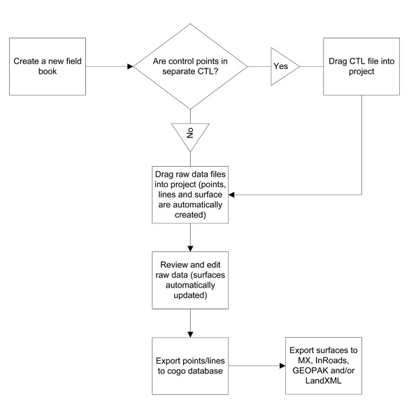
In the process of loading raw data, the system performs the following actions:
-
Reduces the raw data to produce point features and linear features
-
If the Adjustment box (under the field book name on the Survey tab) is checked, then the Least Squares Adjustment is applied.
-
Point and Linear Features, Setup, and Observation data are stored in the DGN. Please Note: Setups, Observations, and Control Points will be drawn to specific levels in the DGN file.
-
Linking Codes are processed to create line work (Linear Features).
-
Points and Linear Features are symbolized according to the Feature Style table.
-
A surface named All Field Books is produced using the points and lines from the raw data.
Survey uses three (3) types of Linear Feature: Dynamic Link, Point List, and Graphic. These linear feature types are hierarchical. A Dynamic Link type can be converted to a Point List or a Graphic type. A Point List type can be converted to a Graphic type.
Linear Features, automatically generated through the use of one of the Linking Methods (Field Code, Consecutive, or Non-Consecutive), are created as Dynamic Link linear features and have a property type of GeneratedByLinking. These linear features are constructed based on the combination of linking and/or field codes and the order in which field points are collected. If a linear feature is started, it will link all subsequent points with same field code until it encounters another start or an end depending on the Linking Method used.